A Day in Hallein, Austria

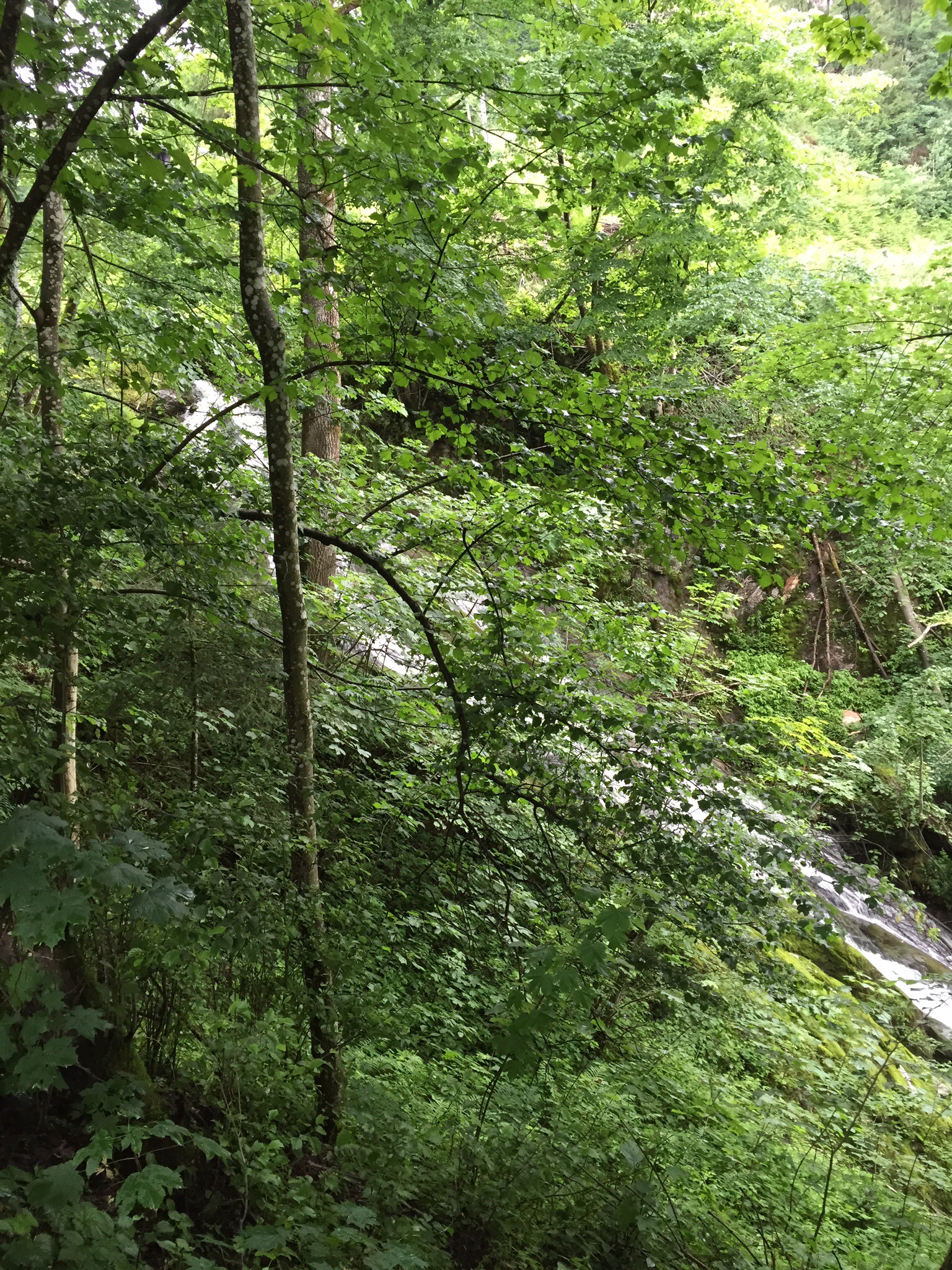
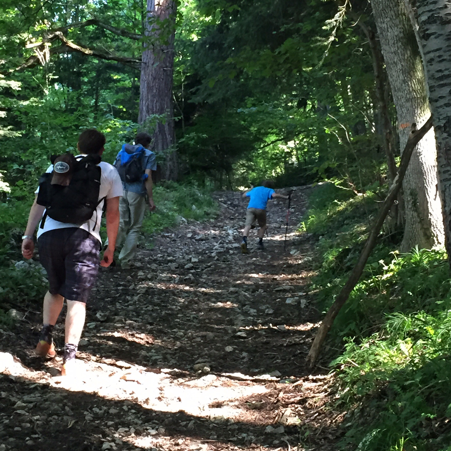
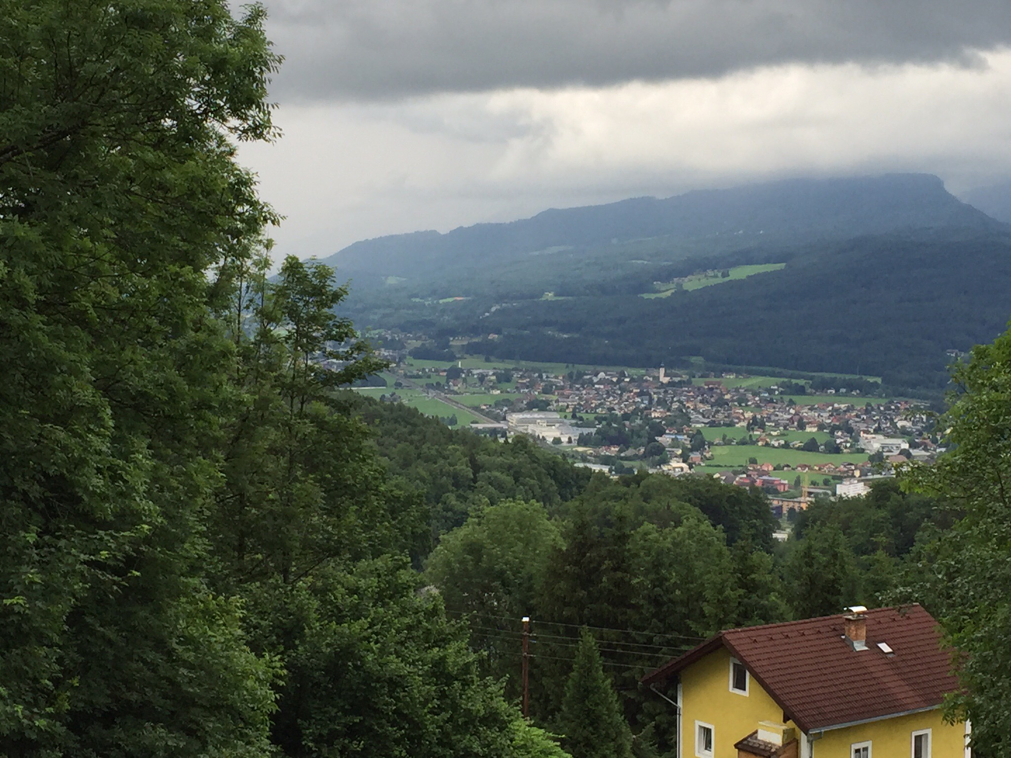
  If you have an itch to head out of Salzburg and see more touristy sights, the city of Hallein is perfect. It is a short journey by train out of Salzburg, at the train station you pick up the bus that heads up the mountain, I believe it was the number 41. (The city has kindly placed a map of the local attractions on a board across the street from the train station that also has fliers to help guide you.) The bus ride only takes a few minutes, I think it was 3 miles, and we got off at the stop with the Salt Mine sign- pretty easy. Now to enjoy the Salt Mines I had to take a deep breath, put on my “I’m a tourist and am ok with that” button and head to stand in line for a ticket. If you are traveling with your family there is a discount ticket so weigh the price options. You get your ticket, and then follow the trail into the visitor center style building to wait for your time. Then you are ushered downstairs to surrender your bags to the coat check and to get dressed in white coveralls. You then board a mini train that is just a long beam that you sit on to be ridden down into the mine. 
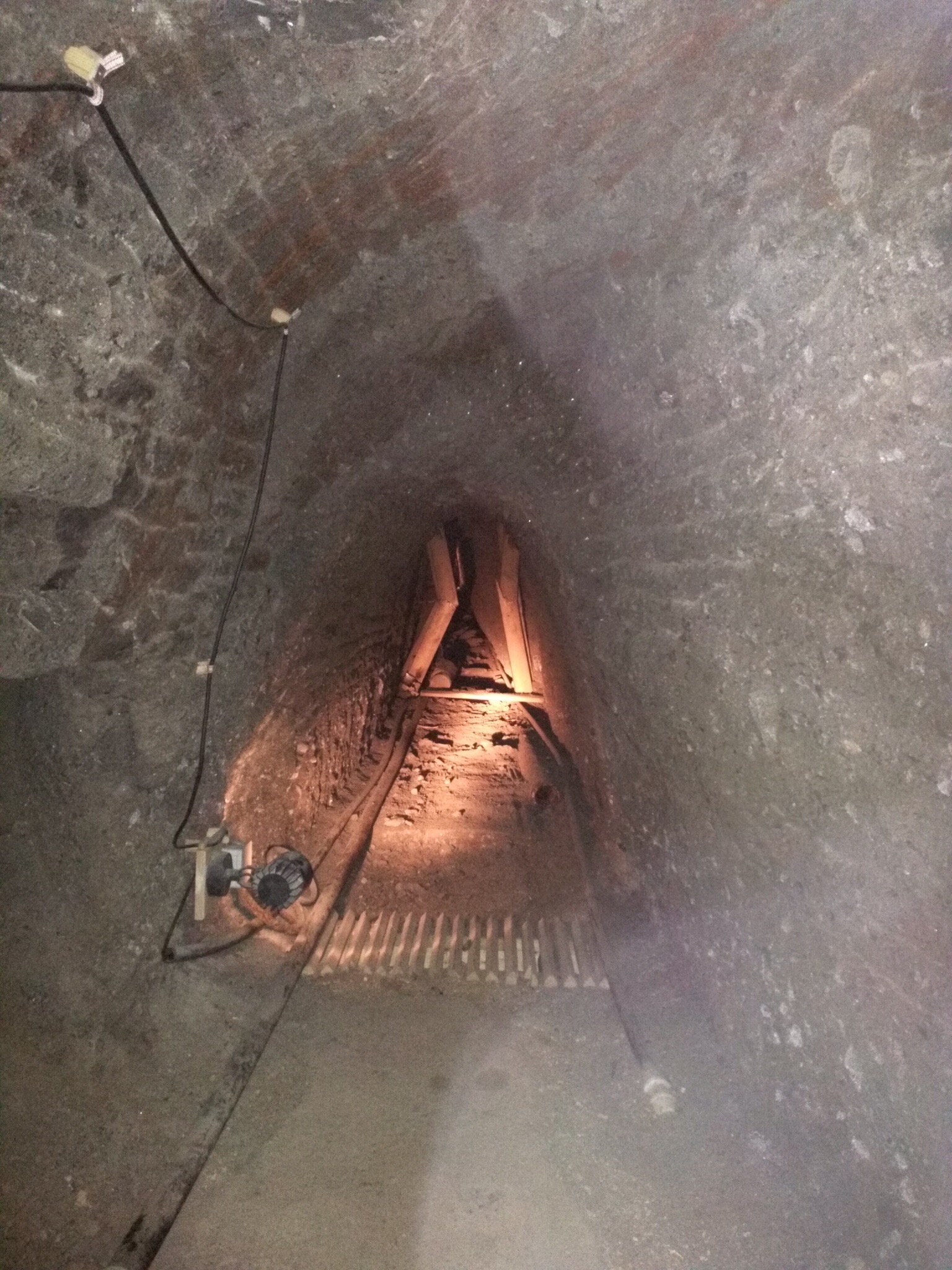
  The tour is nicely done with video stops, points of interest and a tour guide who will provide details in multiple languages. The tunnels have all been widened for tourists but it still feels tight in places and the air is a bit hard to breath. It was two hours of enjoyable touristing as we had to slide down slides in two portions (never fear- they have cameras set up to snap your photo much like the rides in Disneyland) but it was a pretty cool and memorable experience.

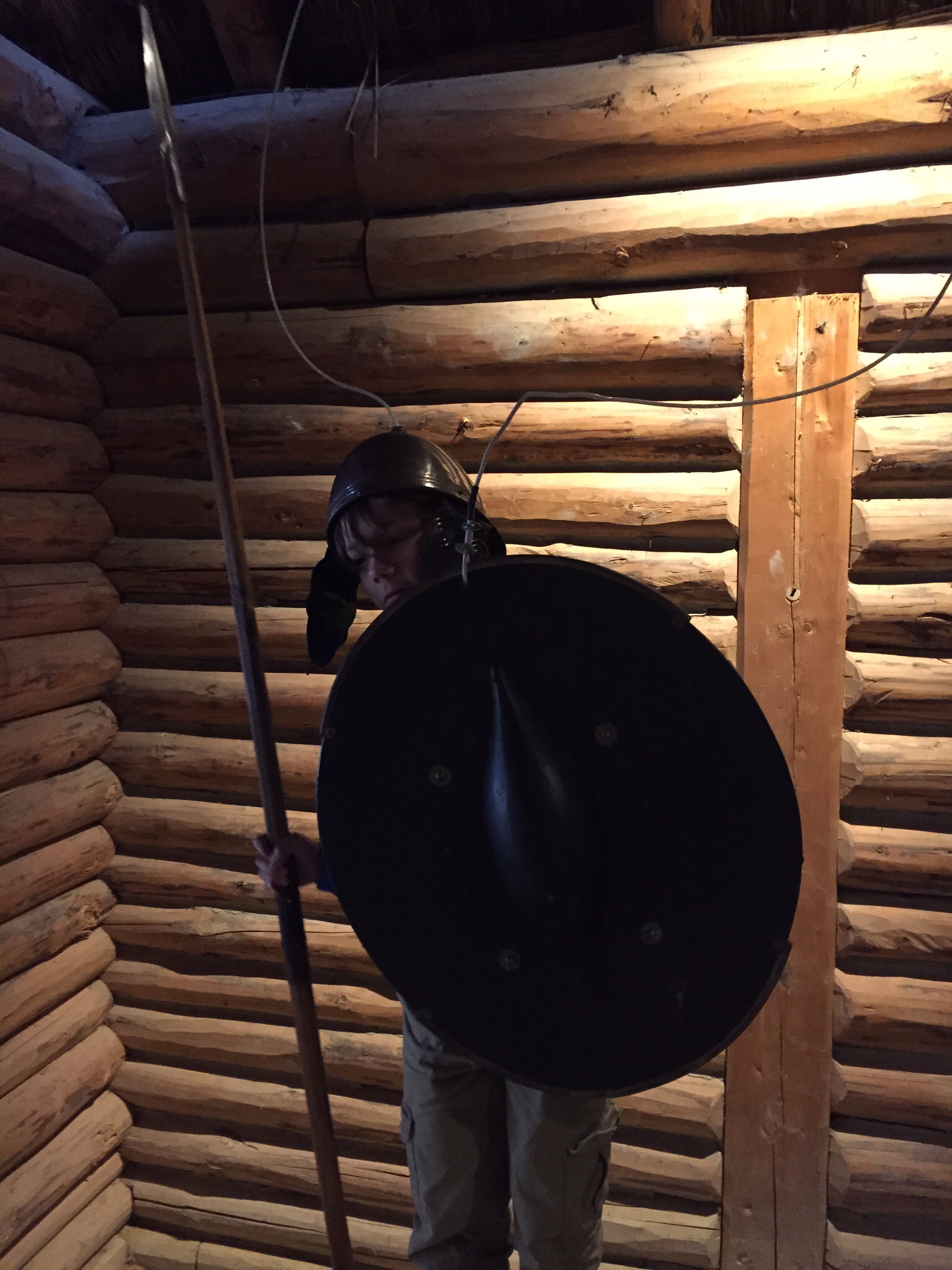
  With your mine ticket you also get entrance to the Celtic Village that is just across from the mine. This was a fun stroll- many buildings have interactive materials which made it very enjoyable for my son. You can practice a little leather working, grind some grains on an old grinding wheel, and even play a little dress up. It is a well thought out exhibit with staff who are knowledgeable and friendly. It isn’t very big but I imagine villages weren’t very big. 

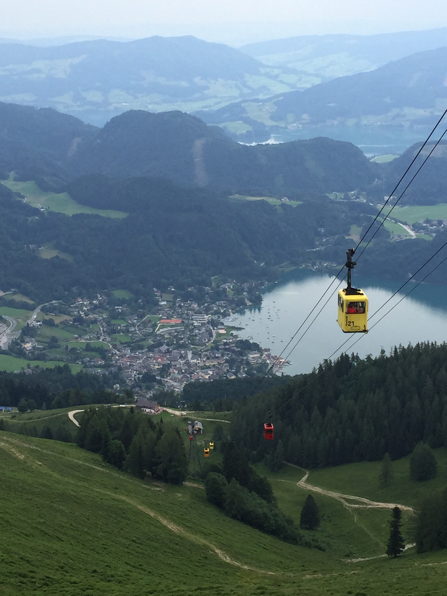
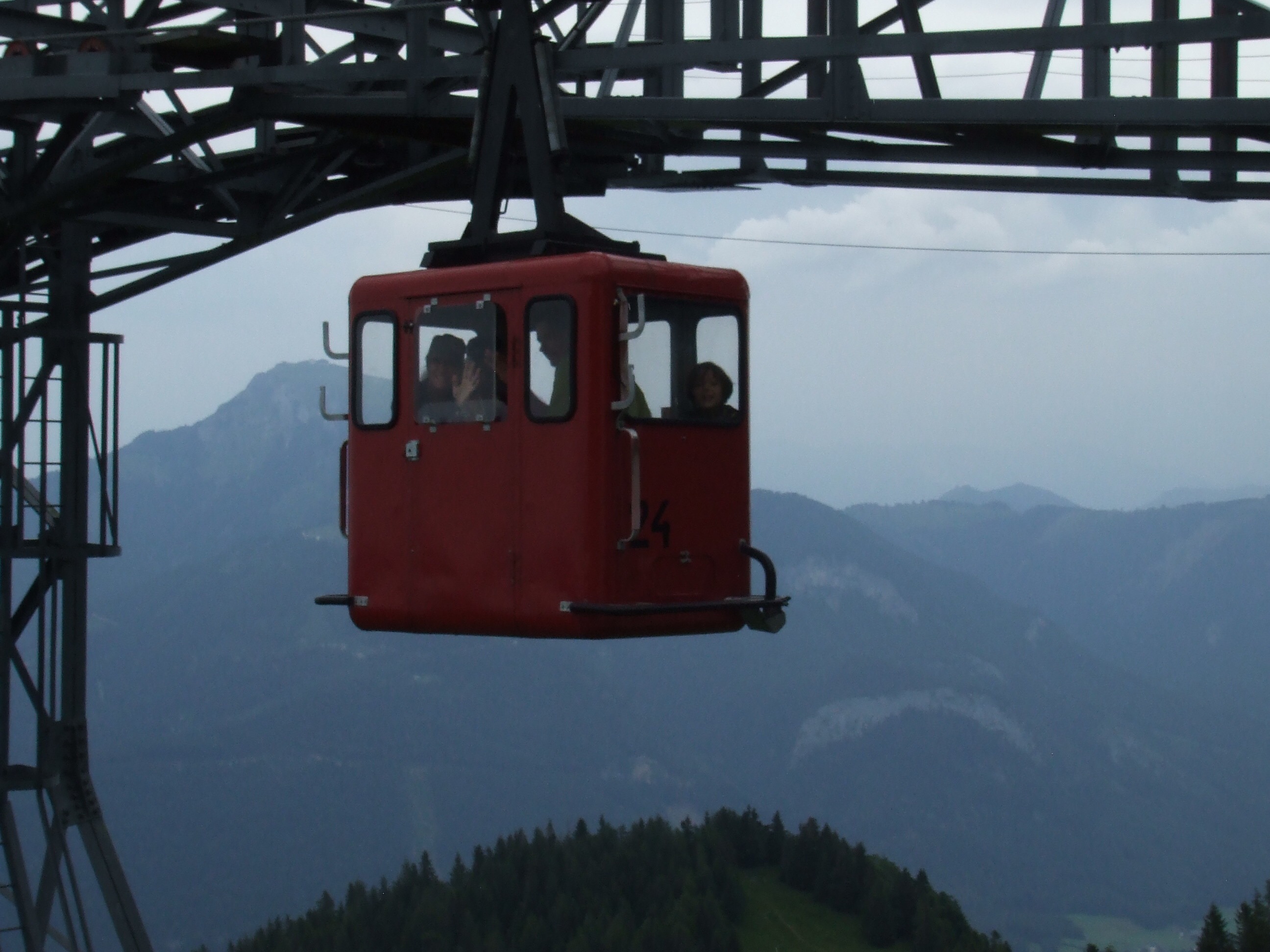
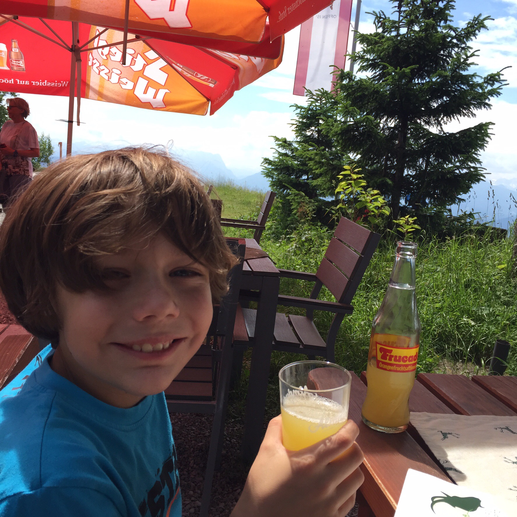
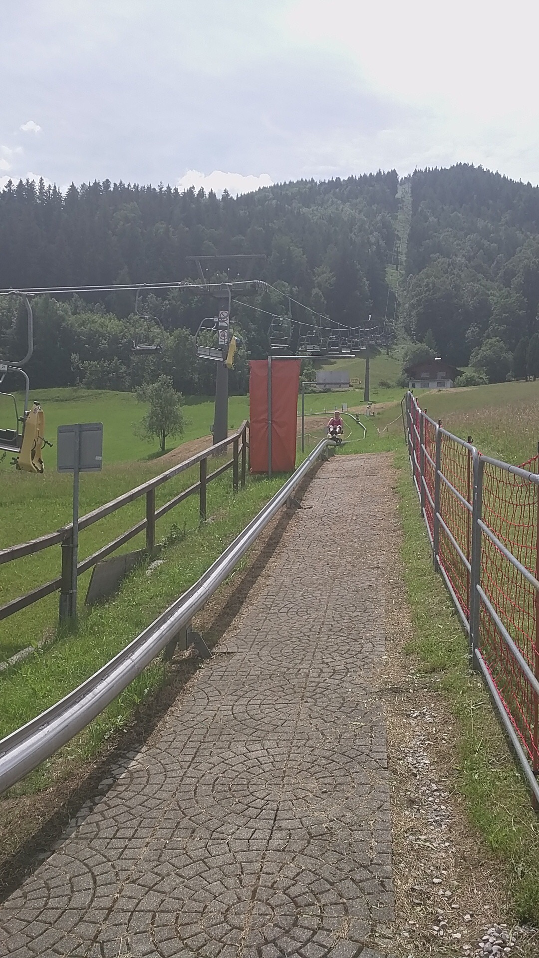
  If you get back on the bus still heading up the mountain from the Salt Mines- you can go one more stop and find yourself at the summer tobogganing (ski lodge) location. There were no lines so we could quickly grab a ticket and be on the chair lift heading to the top. Now again, this is a touristy day and you just have to suck it up as the ticket seems a big expensive. It cost right around 50E for the three of us to take the ride (and of course we all decided to go a second time). At the top of the lift is a restaurant with great views if you are ready to stop and have a snack. The toboggan ride is straightforward and fun. Push forward to go and pull back on the handle to stop. There are some curves that you need to slow down at but the track is well marked. It was really fun as you could get going good and fast. While it is one of the longest tracks in the region, it is so much fun that it feels like it goes quickly and you will probably want to give it a go a second time. They did give us a slight price break on the second ride. 

  We arrived too late to have time to use our ticket to also gain free admittance to the Celtic Museum which is housed back down in town, but it would have been great to go take a peek if we could have. 

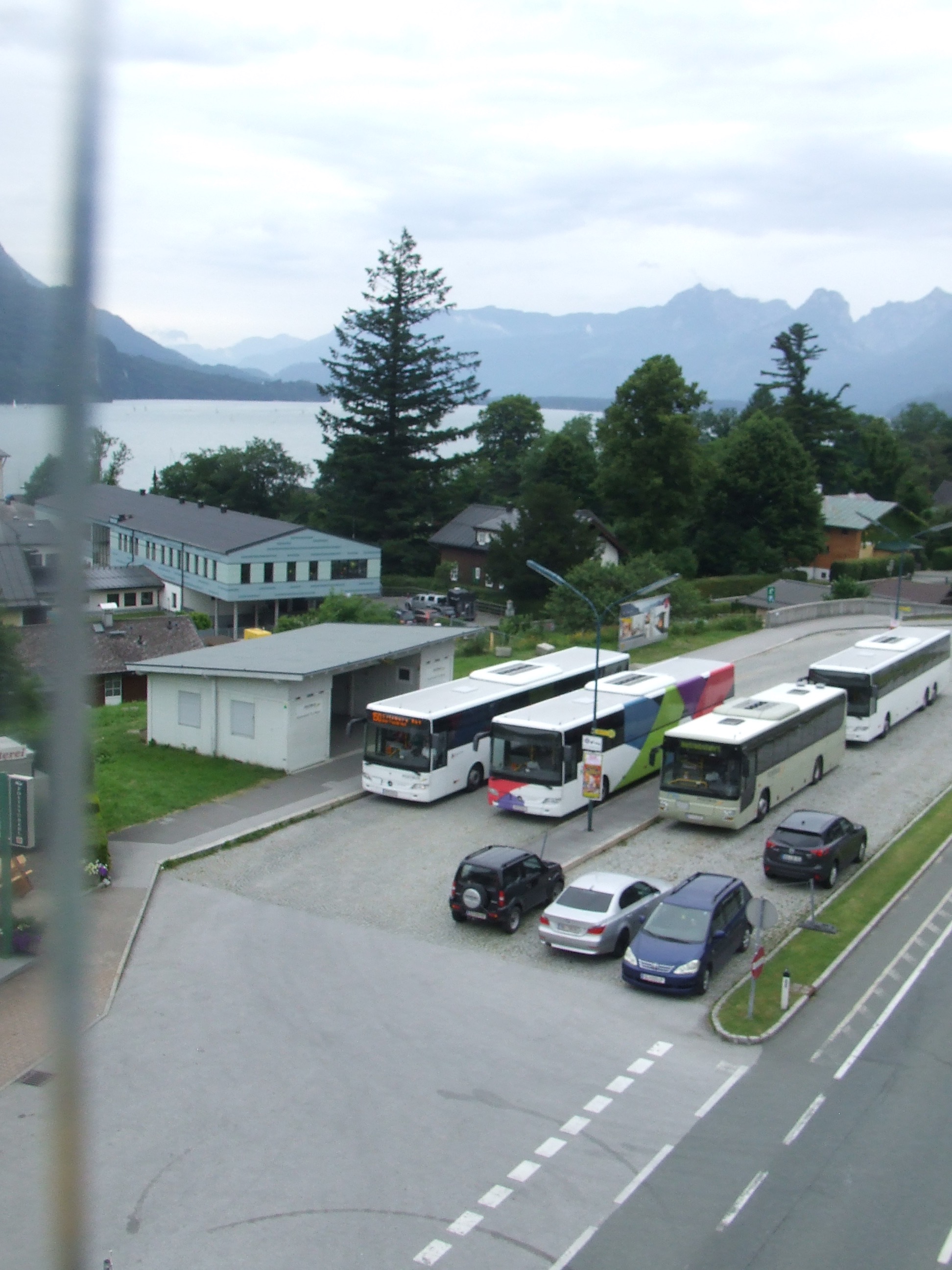
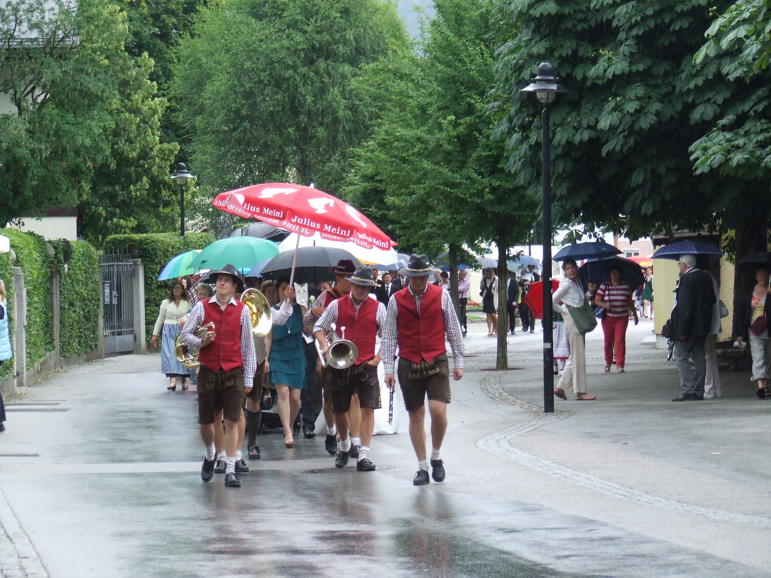
  I suggest planning to spend a full day that can easily be filled with: Salt Mine tour, Celtic Village stroll, summer tobogganing and the Celtic museum. Hallein is a nice city on the river. We strolled the streets looking in shop windows and settled on a charming café for breakfast that overlooked a stream. We had to visit over the course of two days as we came the first time on a rainy day- which was perfect to go down a mine tour, but made the summer tobogganing a no-go as the sleds can’t run on a slick track. My son had seen the Rick Steve’s tour of Austria when prepping for the trip and he had put summer bobsledding as his number one pick of things to do- so we happily returned on a sunny day to throwourselves down the mountain. Hallein didn’t disappoint on either occasion.


A Bit of Lake to go with That Mountain- St. Gilgen, Austria

  
Location: St Gilgen, Lake Region- Near Salzburg, AustriaGetting there from Salzburg: Postbus 150 (about a 45 minute ride) Bus stop is on Schallmooser Hauptstraße close to the intersection with Franz-Josef-Straße. 

   
 Many of the lakes near Salzburg are accessible by bus. The Postbus are clean, modern and comfortable to travel aboard. You pay the driver as you board and can select a round trip ticket for ease on the return. The bus ride doubled as a great tour bus with gorgeous views along the way. We saw countryside, small towns, mountains and lakes. Also, keep an eye out for a building on your right with giant bug-like statues racing out of it. (They are actually bulls because it is the Red Bull headquarters.) After about 45 minutes, and not too many stops, we arrived in St. Gilgen. For some reason I expected the “lake region” to seem like a distinctly different region, where the land opens up and becomes dotted with lakes; but instead it held more layers of mountains, stacked like bowling pins, with the lake firmly filled within the basin.

  Conveniently, the bus leaves you at the base of the gondola and so we were immediately riding up the mountain, craning to take in all of the vista views of the lake and the city hugging its shores as we slowly ascended. Now rain was assured in the weather forecast so we were prepared with raincoats but it was unnerving that there were several warning signs posted to take shelter immediately in case of storms and that the gondola will not run if the weather turns bad. Our worst case scenario would have included at stay in the hotel rooms above the restaurant found at the top. (Not a bad option even in good weather.)

  Lunch was delicious and ended with yummy pancakes for dessert. The place was pretty full with people and many of them sported bicycling gear. Investigating outside it looks like there is a road that winds up the mountain that the bikers take. It would be a fun hike up if you had more time and wanted to avoid the gondola. We spent several hours just exploring the various trails and taking in the views. The kids got interested in the bugs and puddle jumping in the drizzle. Then it was time to head back down and find the lake.

  St. Gilgen is a great little town to wander around in. Adorable shops and restaurants line the streets. We were even treated to a wedding party parading from the church with a great band heralding the way. (I loved that the beautiful, smiling bride was holding a baby in her arms.) There was a fire department sponsored street fair, but I was determined to see the lake by that point and kept going.

  Down by the water you find ice cream stands, lake fish in a big fish tank, a water fountain, a playground and park and ducks. With great satisfaction and contentment I sat by the lake and looked at the sky.


Urban Hiking in Salzburg Austria

  Location: Gaisberg Mountain, Salzburg, Austria
Duration: 1 day

Distance: Up and down (ok, around 5 miles)

   
 For me, Salzburg Austria is quintessentially Europe. There is the old hilltop fortification jutting into the skyline; the old city quarter with cathedrals and squares; a strong dark river dividing the old and new; lots of people bicycling and strolling with purpose, all ringed by imposing mountains. Public transportation is good enough, with trains and buses at your disposal, though if staying close to the city heart it is best to just grab your umbrella and take an urban hike. It is an enchanting location that beacons you to relax a bit, maybe sit along the riverside or hike a mountain just to see the views; it is filled with cafes and restaurants that entice you with ice cream treats and dense German fare. In short it is the perfect place to visit and stay for a while.

  To this girl who spends most of her days in the wide-open South Dakota prairie, it was a titillating delight to be surrounded by mountains in all directions. Locals know each by name and are happy to point them out and describe the charms each offers. Depending on your pleasure there is one within easy access that is waiting for you. We managed to do some hiking, gondola rides, and summer tobogganing; and felt we barely got a taste of what the mountains have waiting. Now there is impressive wilderness stretches in Austria- with glaciers, mountain lakes, meadows and imposing mountaineering- The National Park Hohe Tauern- unfortunately this region will have to wait for a different visit. I spent my time in and around the city of Salzburg and had my fill of the delights of climbing a mountain to find a beer garden waiting at the top. Not a bad reward.

  Now I employ the term mountain loosely here- as most people would call them hills in Salzburg- but they were imposing enough to make my breath catch when I looked down from the top, so I am going with mountain. But according the “The Sound of Music” (which was filmed here and actually is one of the reasons tourists visit) those hills, they’re alive with… well you know. We had no trouble finding transportation to hiking trails. The day we set aside for a longer hike, we just simply walked out our door and headed in the direction of the mountain we were aiming for- Gaisberg. After about a half hour walking through the city we started to climb and then met up with the dirt path. The nice thing about mountains is if you are hiking up you just head up the trail and when done go the opposite direction. There were many trails but you never had the sense that you could get very lost as there is a well-used road that runs to the top that you could always manage to find if needed. The trails are blazed with a red and white marker which, after being on several trails, I started to suspect really was the marker not so much of the trail but that you were on the right path to the beer at the top! The terrain changed from beautiful old farms, to meadows, to mountain forests; lovely every step of the way. It is difficult to gage the difficulty of the trail as we were led the entire way by my 9 year old son who charge up and then down, and was managed by my aunt; so we had three generations able to enjoy the hike but it in no way was an easy walk in the woods. We had hiking poles that we were glad for as the constant incline, coupled with areas of rock and forest debris, did make you watch your feet more than the views in sections.

  We all happily enjoyed relaxing at the restaurant once we reached the top. You can have the weiner schnitzel and beer guilt free knowing there is the whole second half of the hike still ahead. The views catch your breath as you see the Salzburg panorama while the brightly colored hang-glides take off and float and soar. Good cheerful conversation with friends completes an amazing morning. Revitalized, you get the luxury of making an “urban hiking” choice: save the knees and take the bus down, or extend the hiking pleasure and walk back the way we came. You know what we picked! Down was slow on me but it brought a grin of delight watching my son sliding and skidding down the rocky areas with confident delight. The round trip, door to door, took 8 hours.


Blue Mounds State Park- Minnesota

Location: 1:20 minutes away from Brookings, SD just north of Luverne, MN.

Distance: 13 miles of trail

Difficulty: Easy- day hiking for the whole family

Dogs allowed on leash


Mother’s Day hike with the entire family at the Blue Mounds State Park which is an easy drive from the house, perfect for a quick day hike. The climbers I know keep inviting me to head to Blue Mounds for the climbing, so I wanted to go do a bit of reconnaissance; and when I looked it up online and found it had 13 miles of trails and a buffalo herd, I was sold. 

The hike itself is the perfect high interest trail for the kids to get involved in. There are many trail markers/sign posts for them to stop at and practice their navigating skills; as the entire trail is mowed it is impossible for them to get lost. We started heading out along the bison field; which kept the kids moving along as they were seeing who would be the first to spot the herd. The only downside being that you are hiking along a huge prison-style fence; which is a pretty good scene killer.  There were several false spottings of boulders but once we did find the herd, it was the perfect opportunity to sit on a big rock and have our snack. 

The trail is essentially an oblong loop along the ledge of the rock wall. For the three hours we were there we saw an impressive number of animals. Bison herd, white tailed deer, a snake, a whole host of insects, vultures and assorted birds. The terrain is slightly rolling but gentle on the knees. The kids had a blast hunting the cactus and watching for animals. The trail is a perfect family day out.

While we only had a short time to explore the entire family agreed it is a great spot to go back and check out again. The park has done a really good job of making itself interactive and enjoyable. The signs stated that we could rent canoes, check out fishing equipment (free), bird watching equipment (free) and there was a scavenger hunt/geocache along the trail. The trailhead sports a vault toilet, volleyball and a swing set. This is just a very enjoyable little place to bring the whole family and enjoy a picnic, view some wildlife and get a little (though mild) trail action. 

Final thoughts- high interest level for the kids and nice and relaxing for the parents. Not a bad way to spend a day!

http://www.dnr.state.mn.us/state_parks/blue_mounds/index.html

How to Not Run a Half Marathon

What I did wrong on Saturday and how I plan to fix it.


I confess, I didn’t train for the Brooking half marathon on Saturday. Every marathon/half I have run has left my stomach in nervous knots the morning of, this was the first one that the nerves were from under training. As with all things in life, I learned a bunch by undertraining and hitting the road anyway. When I signed up for the half I had good intentions of making my training calendar and sticking to it. I let the cold of winter and the business of spring act as excuses for not getting my miles in. I never wrote down how many miles per each date and so just ate up whatever miles felt good on any given day. 

I want to share what I did wrong and throw down a challenge to myself to do it right between now and the Sioux Falls half in the fall and see how the results change.


Error: No running calendar.

Fix: Program the proper distances in my ipad calendar where I will get a daily reminder.

Error: Anticipated walking/hiking counted as cross-training. 


Fix: Add in better complimentary cross-training.


Error: Pizza and beer the night before the race.


Fix: Think and eat smart. The indigestion combined with nerves also meant that I was awake from 2am on the morning of the race.


Error: Got out of bed too late for proper food/drink.


Fix: Sleep!


Error: No stretching the day of the race.


Fix: Stretch out before and after. Still have sore muscles days later. 


Error: Only coffee for food/drink all morning and throughout the race.


Fix: Experiment with foods that you can keep down in the morning in training. (Banana?)


Error: No plan for pace, timing or expectation for completion time.


Fix: Train to a pace and set an end goal. Set my own pace (ignore other’s footfalls!) and experiment with music as a tool to up the tempo. 


Error: First run in my brand new shoes. 


Fix: Plan ahead for mile wear to my shoes and order/break in before the old ones are dead.


The list could expand but the important thing is the plan for change. I will change my mental game and think of myself as in training. I will make a graduated plan that I will adhere to, and the funny thing is that when I consider myself in training I begin to take better self-care. I eat better, sleep better- even wash my hair more. So I guess at the end, I will make a plan to care for myself better so that it doesn’t feel like I am pounding myself into the ground with every foot fall. Yes, guts and courage (sisu!) will get you through 13.1 miles but next time I hope to do it in a more gentle loving manner. 


Brookings half time: 2.12


Sioux Falls goal: under 2


Finish line, Brookings, SD.


Hop Valley Trail Part 2

Zion National Park- Hop Valley Trail part. 2

Day three on the Trans-Zion trail. 

By our afternoon break and snack we had made it through the Hop Valley and assumed we would be climbing out of the valley and get to the trailhead. We did climb out, and found ourselves on what appeared to be an old jeep trail that just continued to climb at a steady tolerable rate, for an hour. We happily emerged through a gate out of a pasture to the trailhead sign, yay! Though we didn’t see the car the other hikers said they parked at the trailhead and the road wasn’t where it should be according to our map- they don’t just go and move roads so we must not be as far along as we thought. Bummer. In fact we still had a good bit of the connector trail to get to the formal trailhead, but it was worth it as we found a vault toilet and garbage cans. Super extra bonus was that I had cell phone reception for the first time- I was able to call and discover all of my children (and my hubby) were still alive and well. 


In the shadow of this surprising bit of civilization we ate tuna sandwiches (it is amazing out good a tuna packet spooned out onto slightly stale bread can taste!) and assessed our situation. Several things were clear:

1. The weather was pretty crappy. The winds had managed to blow in rain clouds that we could see dumping on various portions of the park in the distance. 
2. It was dinner time and we still had roughly 4 more miles to go and needed to find a suitable campsite, with luck in daylight. 
3. If the wind kept up would our tent stay put/upright through the night? (Yes, we indulged in the fantasy of perhaps setting up camp in the vault toilet to stay out of the winds.)


A second quick call to my husband to check the weather conditions encouraged us to keep going. Ok, so my husband told me we were silly and the tent would be fine. Done, and done. Off we went. (Knowing in the worst case scenario that there was another vault toilet at the Wildcat Canyon Trailhead.) On we marched with A.J. taking the lead and totally pulling me through the next few miles, thank you friend! One change that occurred at this point is that we had wandered into the land of the park rather than the wilderness. Again we had easy to follow trails and beautiful views. The one disappointment was that we found tons of deer scat but even though we passed through some wonderful open field areas, at dusk, we didn’t get to see any. This section was rather flat and enjoyable; however, once we got closer to the Wildcat Canyon the terrain changed to going over the rock formations we had been viewing from a distance all along. I was disheartened that the light was starting to go and we now had to scramble up and over rocks being guided only by stacked rock trail markers. The disheartening part is that earlier in the day I would have squealed with delight to clamor over such a fun feature, but now I was just tired and this was another obstacle between me and camp.  We pushed hard and were thrilled when we made it to Wildcat Canyon around 8 o’clock. The wind was crazy sounding up high in the trees but it was relatively calm down on the canyon floor. We hunted around as much as we dared in the fading light for a site that didn’t include a host of dead trees to shed their limbs on our heads in the night, and set up camp in record time. We did take the extra precautions of staking the tent everywhere and tying the rain cover to a tree trunk. (The crazy wind had entered my psyche and I had wild visions of headlamp lights flashing in the night while we raced to catch a rain cover billowing away in the night.) 


Heading into our bags for the night (did we even eat anything?) we soon discovered that the wind was having fun sneaking along us in the tent and sucking warm air from our sleeping bags. We experimented with layers of clothing and jackets draped over our bags but ended up spending a pretty cold night. It was so cold that we both agreed that the next day we wouldn’t roll out of bed until we could see some sunlight in the camp. But we can talk about that on day 4. Good night.

Zion National Park- Hop Valley Trail Part 1

Zion National Park- Hop Valley Trail Part 1

Day three on the Trans-Zion trail. 

Distance: Roughly 13 miles depending on camp choice.

Difficulty: Ranges from easy to moderate.

Water: Available but advised to not filter and drink.


The Hop Valley Trail leading us to our camp-at-large permit site in the Wildcat Canyon was set to be our biggest day of challenges along the Trans-Zion; first of all it was our longest stretch of mileage in one day around 13 miles, and second it was the stretch that included no water sources and a dry camp once we made Wildcat Canyon. So we decided to get up early, break camp and hit the trail; which in our tucked away canyon camp with no sun until late morning ended up as an 8am wake up. Nearly as soon as we crawled out of our tent it changed from a still morning to a windy day with a tremendous wind that started breezing through the camp making our camp stove work double time to produce some luke warm tea water. 


We chatted about the regrettable case of our camp requiring us to backtrack nearly an extra mile that would have been avoided if we had moved our camp further south the day before, but we concentrated on creek hopping and planned to tank up on 6 liters of water each once we hit Camp 10; only we stumbled upon the trailhead before Camp 10 (*spoiler alert: first big mistake of the day about to commence) we were advised that Beatty Spring was nearby but weren’t sure if it was along LaVerkin or the Hop Valley Trail and so decided to head up the Hop Valley and hope it appeared. Two things: first the ranger said that this is the biggest spring along the route, that the vegetation changes considerably and you could probably hear the spring as it was so big; second, the Hop Valley sign had scratched into it the word Spring (thanks fellow hikers) however, it had an arrow pointing one direction with an X through it and a new arrow pointing the opposite direction. Leading us to feel we might have faulty intel. at best. Now, we should have stopped and consulted the map and figured this all out but in our excitement we pushed on hoping for the best. 


Hop Valley is, of course, a valley. To get into the valley the trail turns into a rocky uphill grind to get over the ridge between the creek and the valley. So we headed up continually looking to our right anticipating vegetation change to lush greenery and to hear the lovely tinkle of running water. After close to an hour of up and head careening right, we admitted defeat in finding the spring that was never along this section of trail to begin with. We assessed our situation, we were on the longest driest score of trail with less than 2 liters each. There is water in the Hop Valley but the warnings against drinking it (I kid you not here) ranged from “I would drink it filtered if I were dying, maybe.” to “If you are dehydrated, drink it.” (I really think these two opposing views were offered by the same ranger at different times, on the phone a week earlier and then in person the day we began.)My partner A.J. voted we push on and just plan to get water in Hop Valley and I voted to be cautious and head back to a large known water source, LaVerkin Creek. Prudence won out, and we ditched our packs in some scrub brush, fashioned very fashionable water carrying belts of cords and carbineers and headed back down the Hop Valley Trail. And then back over again once we had tanked up. (Mind you, still never finding the Beatty Spring even while we looked again, now to the left the entire way we went.) Curse you, only slightly mind you, Beatty Spring. Honestly, if the rangers had just said to ignore the spring as there is plenty of water in the same vicinity from the creek we would have saved a huge amount of time and effort.  


After finding our packs, having a quick snack and slathering on the sun screen we finally headed out to truly being the Hop Valley Trail. Staggering a bit under the nearly 10lbs of new weight. The trail begins with the rocky uphill climb, levels off in a rather narrow valley where we were welcomed by wild turkeys, and then descends further down another rocky bit to finally come into the large beautiful Hop Valley. The entire landscape opens up with water meandering along a sandy bottom, pastures and more gorgeous rock formations lining the valley walls as far as the eye can stretch. 


Regal trees pop up in unexpected places as you pump out the easiest set of miles over the entire day. You immediately cross the water (you will cross back and forth the entire way) and find the trail by the marker. We were warned the trail is sand, and sand it is. Heavy beach walking kinda sand, with your heaviest pack- yep. You quickly find the two camps as they are on the closest end of the valley, and can’t help but fantasize a bit about hefting your pack off, setting up camp and lying under one of the gorgeous trees in the grass reading a novel or taking a nap. Instead we pressed on enchanted by the wonder of our surroundings but one factor was become non-enchanting: the wind. A.J. had her contacts in and the strong steady headwind kicked up dirt into our eyes causing several blinking stops and it forced us to lean in further. This was the first portion of the trail that felt like we owned the place without another soul around and the flat terrain made for some relatively easy miles. There is evidence of cow grazing mainly in the way of old fence posts and cowpies. We didn’t see any more turkeys but it was fun seeing their tracks down by the water- huge feet! 


There are not a lot of signs pointing the way, but there were tons of boot prints. It didn’t always pay to follow the boot prints as several times they led in a way that clearly many people thought was the way but actually wasn’t. With the sandy sand on the trail and the compact sand along the water, I would suggest keeping the trial within sight but walking along the water instead; knowing that you are in a valley and you came in one direction and have to leave in the other direction. Now when you get to the end of the valley it is inexplicably confusing. The water will decidedly turn left and head between two rock walls, the trail will appear to keep heading straight ahead, and then there is a trail marker that appears to point straight up a hill where there are countless boot prints all around. If you stand directly in front of the trail marker and face the way it is pointing you will find it isn’t really pointing up the hill, and the trail is so worn that it is pretty easy to decide to keep heading in the correct direction; I can only assume the marker is where it is due to the boundaries of private property that are clearly marked in the area. We did encounter one other party of a man and woman heading in the opposite direction, we found out from them that the wind was forecasted to hit up to 65 mile per hour gusts and turn in the night to come from the North. It is funny how the wind felt much harder to battle after that news; but I kept saying wind is easier than rain to deal with.

Water Filter Props To the Platypus GravityWorks

Because Water is Kinda Essential


Platypus GravityWorks Filter System Bottle Kit – 2 Liter

One of my favorite pieces of gear in my pack is by far my water filter. For years the hubby and I had this pump action, top of water bobber system that stank. You would work hard to get the water pumped out and the float would often pop out of the water in the process, while simultaneously moving the water tube enough to stir up sediment from the bottom. We never needed to use this in a trickle of a stream, which is a good thing, because I am not sure we would have had any success.  

But now we don’t worry about any of that, we just let gravity do the work. When we were looking at our outdated gear last spring ahead of our 3 day trip along the Lost Coast of Northern California many things were replaced with newer, lighter items. Our sleeping bag volume was halved, the cook pot kit dropped half its weight; but I balked a bit when we got toward the end of the spending spree and my husband kept eyeing a new water filter; after all, we had one that worked couldn’t we keep at least one old item for budgets sake? I sighed and handed over the credit card one more time to the REI gods, and our Platypus GravityWorks Filter arrived. I was stunned. You filled up the bag (clearly marked dirty water, thank you very much) and just sit back and wait for the water to flow down and into your bottle. I was a bit stunned by the simple genius of it.

Longer to set up than to fill

 How it works. 


Fill the dirty bag with water. The nice thing is that is can ben dipped in a larger body of water or held under a trickle to be filled. You attached the hose connection that includes the filter with a one snap system, that can be accomplished with one hand while holding the water bag in the other, and put the lower hose into your bottle (it has several options of end pieces to fit different bottle styles) and then hold the bag up or use the strap to attach it to a branch to await your clean water. We did have a problem with slow flow, but a quick read of the instructions included in the carrying bag showed we just needed to backfill the end section of the hose with water from our clean bottle and then it picked right up again. It generally took longer to get the filter out, fill the dirty bag with water and attach the hose to the bottle, than it did for the water to actually filter through the system and into a liter bottle. Pretty quick filtration. The product description states a flow rate of 1.5ZL per minute but it at least seems longer than that in practice.


Potential Drawback.


The extra 2L water carrying capacity came in extremely handy when we needed to fill up 6L per person for a day and a half stretch without any water sources. What we didn’t expect was to wake up from a night of 22degrees with a dirty bag filled with ice water- heavy on the ice. Only after putting it on a branch in the sun and attempting to fill what we could of a water bottle did we notice the warning on the side of the filter saying to not freeze the unit. Does filtering ice water count as freezing the filter? Fortunately, the filter portion had been insulated within my pack inside the rainfly of the tent and didn’t actually freeze, and the filter did perform fine after the ice water filtration, but it does highlight a potential drawback to the system for a girl who lives in the wind-swept frozen tundra. 


2 extra liters to go.


Overall the Platypus GravityWorks water filter works smashingly well. At the meager weight of 9.5oz and priced right around $100 it is one of the best investments of space and money I have made within my pack. 


Zion National Park- LaVerkin Creek Trail

 Time of year: Mid-April

2 nights as the first portion of the Trans-Zion trail from Lee Pass to the Groto

Distance: About 8.5 miles one-way. 

Difficulty: Easy- very wide well-established trail that is well marked with all camps numbered with signs. Some up and down on the trail and some creek crossings. 

Water is continually available once you have descended down to the creek which will take no more than an hour or two depending on speed. 


Less Pass Trailhead consists of a series of parking spaces with a sign clearly marking the trailhead. You descend immediately down along a mixed rocky/dirt trail. 

My hiking partner and I excitedly headed down the trail. We encountered several other hikers early in the day who were out day hiking to see the Kolob arch. We even trailed and criss-crossed for several hours with a small group of horse riders along the trail. The terrain and views are magnificent, with early spring flowers and tree buds at our boots and the gorgeous expanses of the canyon walls and peaks when we looked up. You certainly can’t help but feel intimidated and humbled when you first step onto the trail and look around and the cathedral-like expanses of stunning rock that surrounds you. The trail immediately enchants with lizards scrambling into the sunshine atop boulders, random butterflies and moths floating by on the breeze and an interesting varied landscape with new plants around every winding curve of the well-established trail as it heads down to the Creekside. 


We passed along all of the camps during the course of the day, if your goal is to see and play near the arch, camps one and two are disappointingly too close to the Lee Pass trailhead; they appear to best serve those who are hiking out to Lee Pass and wish to spend one last night on the trail. All of the camps are very well established and will easily accommodate the group sizes that they are rated for. They all appear to have several clearing options for tents, logs/rocks arranged conveniently for sitting around your cook stove, the Creekside nearby for water, and trees for hanging food and shade. No campfires allowed. Camps 7 and 8 were very close together, ideal for multiple groups wanting to be close to each other and are near the water. Camps 9-12 are all close by the water. If I go back along this section of trail I would ask for Camp 10, it is near a tiny waterfall feature of the creek, it is on the opposite side of the creek from where the main trail travels and it is ideally situated to both reach the Kolob arch as well as continue onto the Hop Valley trail if going further on. 


We spent two nights in Camp 12. It took us about 5 hours to go from the trailhead to Camp 12 including multiple stops to enjoy the scenery and to have water and food. Toward the end we did make multiple crossings of the creek which have many stepping stone options, but it was much easier to navigate the weight of the packs by using hiking sticks for stability when crossing. It was a very nice camp that met all of our needs with nice trees and close proximity to the creek. It was pocketed away more in the canyon than we expected making it late morning before the sun made it into our camp. We saved the arch for day two so we would have an exciting landmark to go explore when we woke up. The day two hike back to the arch over familiar trail was great fun and going to see the arch with lightly weighted packs and plenty of time made it feel a bit like a vacation within a vacation. 


Once you turn off of La Verkin trail up toward the arch it is only another .5 miles until you get to the viewing area. The arch is still very far away and there are multiple trees that make it a bit obscured but it was still a neat feature to get to check out. We chose to continue on and hike the trail up the creek past the arch to find yet another small waterfall. It was fun tripping along the streambed exploring further afield, but in truth, there isn’t much change to the landscape as you continue. When we had our fill of the arch trail, we headed back to our camp, and I must admit it was great to head back knowing camp was already setup for us. We chose a leisurely afternoon of washing out our clothes, taking a creek bath and an early dinner. After dinner we donned our flip flops, and took a flip flop walk further up the trail toward camp 13, we chose to turn back after about a half hour as our footwear wasn’t ideal but did see even more glorious rock formations that really shone in the late afternoon light. The weather was amazing the first two days reaching the upper 70’s during the day and the low 40’s at night. The nights were cool with the sound of the creek soothing our weariness and the stars were stunning.   


 We turned in early knowing we needed to pack up early and head out of La Verkin the next day to tackle the longest stretch of our Trans-Zion journey the next day. While it was great fun having the same camp to come home to two days in a row, it would have shaved a good mile off of our longest stretch if we had moved from camp 12 down to 9 or 10 for the second night which are more closely situated near the Hop Valley trail head.


Trans-Zion Success!

I know everyone has been waiting to hear about the Zion trip. My hiking partner and I had an amazing time traversing the Northern region of the Zion National Park Wilderness area. Starting at Lee Pass and ending down at the Grotto. We covered over 40 miles in 5 days and witnessed some sensational scenery and had a great time testing our limits and enjoying some communion with a wondrous location. Over the next few weeks I will break out the details and adventures we encountered but here is a sneak peak at some of the views!


Location: Zion National Park

Season: Mid-April

Conditions: ranged from mid-70’s during the day to lows of 20 at night with wind gusts of up to 55 miles per hour.

Terrain: varied from flat valley floors to creek crossings to climbing rock switchbacks to the Rim.

Difficulty: Moderate

Pros: scenery, easy to follow trail, fewer people than the main park.

Cons: water resources can be scarce, distances between camps determine the daily mileage more than the hiker’s preference, wind and cold temps.